


Blow Me Down – Great Hikes in the Corner Brook Area
Why You Shouldn’t Skip Over This Area
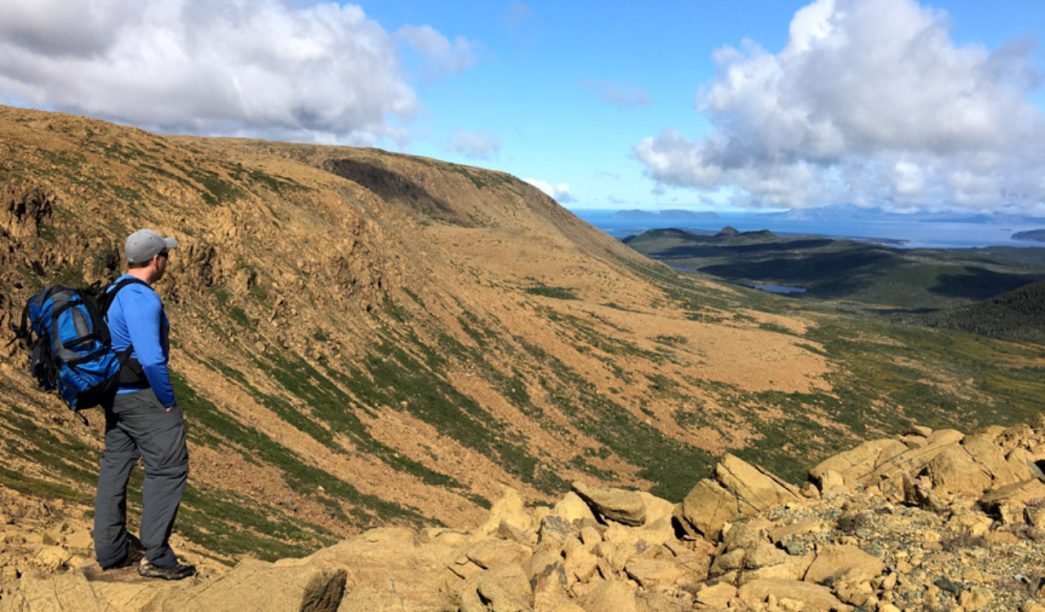
The Blow Me Down Mountains in Corner Brook are an awe-inspiring sight and the perfect place for avid hikers to explore! Named after the strong wind you’ll often find at the top, these mountains make up one of four mountanous plateaus in western Newfoundland where you can walk on the earth’s mantle!
The Lewis Hills, The Blow Me Down Mountains, The North Arm Hills and The Tablelands. These four plateaus are currently in the process of becoming a Geopark. Cabox Geopark, named after the tallest Mountain in Newfoundland, The Cabox.
The geology here is so similar to that of Gros Morne that it was one of the areas considered for the location of the national park before it was ultimately centered around Gros Morne mountain. Instead, you can find the small Blow Me Down provincial park Newfoundland. is in the process of becoming the Cabbox geopark! named after the tallest mountain in the park.
Hikers should be prepared for an adventurous experience as they traverse through this rugged terrain. There are several trails to choose from with varying degrees of difficulty, ranging from easy loops around scenic coastal cliffs to some of Newfoundland’s most challenging and rewarding backcountry hikes.
Be warned though, Newfoundland’s backcountry doesn’t come with trails. There simply aren’t enough people that travel these mountains in a year for a trail to form – Imagine that? Going for a hike and not seeing a soul. If you’re willing to hire a guide at Everoutdoors, or are confident with your gps, you can truly experience just how rugged and isolated these mountains can be.
The Best Blow Me Down Trails
Cedar Cove Trail
This easy trail is a 3.7km out and back hike with 80 meters of elevation gain. It will take you to scenic Cedar Cove. Nestled between cliffs Cedar Cove has a very secluded beach with a lovely area for overnight camping.
There are no amenities besides some flat ground and a small stream that leads to the ocean. The beach boasts some of the best beachcombing in Western Newfoundland.
The trailhead is here. More info can be found here.
Little Port Head Lighthouse Trail
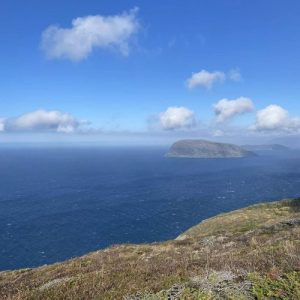
This very hard trail is a 4.6km loop with 300 meters of elevation gain. This Trail starts on the Cedar Cove trail about 1km in you will take the turn off to the Little Port Head trail. Immediately after this turn off is a scramble straight up 300 meters to the top of Little Port Head.
Be mindful of the ropes as they’ve been put there by random people and are not maintained. At the top of Little Port Head are the most spectacular views of the largest sea cliffs in the bay of islands.
The descent from Little Port Head down to the lighthouse is almost as hard as the ascent, and if it’s muddy can be quite dangerous. Again there are ropes here but they’re not maintained. If you want to get a taste of what to expect backcountry hiking this hike is a good test without too much commitment. The views are worth the struggle.
The trailhead is here. More info can be found here.
Bottle Cove Trails
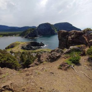
This easy trail is a 2km loop with 30 meters of elevation gain. This is the most accessible trail in the area. The trail leads to Miranda (Island) Cove, Sunset Rock, Bottle Cove Beach & Captain Cook’s Trails End Monument.
There’s also a sea cave at the mouth of Bottle cove you can get to. The coastline here is interesting to explore and the sunsets are unmatched in Bottle Cove.
The trailhead is here. More info can be found here.
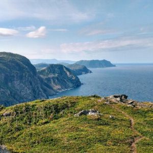
South Head Lighthouse Trail
This hard trail is a 5.1km out and back with 370 meters of elevation. This trail takes you from Bottle Cove past a small waterfall to the top of South Head, overlooking the site of the former Southhead Lighthouse. There are boardwalks throughout the trail but expect the trail between them to be on the rough side. Top of the original lighthouse is situated on the trail parking lot as the lighthouse was dismantled in 2010 and replaced with an electronic beacon.
The trailhead is here. More info can be found here.
Murray Mountain Trail
 This hard trail is a 7.7km out and back with 470 meters of elevation. The Murray Mountain Trail is a tough hike that will satisfy the needs of the ambitious hiker. You will start at Lark Harbour Town Hall, before heading through a wooded area with steep ascents. You’ll then break away from the tree line and traverse across bogs and rock formations until you reach your destination: the top of Murray mountain with the second tallest 360 degree views in the area!
The trailhead is here. More info can be found here.
James Cook Heritage / Lark Harbour Head / Tortoise Mountain Trail
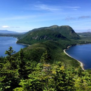
This moderate trail is a 5.3 out and back with 280 meter of elevation gain. This hike is confusingly known by three different names. It is the only Blow Me Down provincial park hiking. It starts on the beach in the Blow Me Down provincial park. From there you’ll head up the Governor’s Staircase – a wooden staircase embedded in a rock wall.
The trail will take you 1km further to an observation deck part way up. Beyond the observation deck the trail quality degrades a bit as you continue to the top of Lark Harbor head / Tortoise Mountain. More wonderful 360 degree views of the Bay of Islands
The trailhead is here. More info can be found here.
Cape Blow Me Down – Previously known as the Coppermine Trail
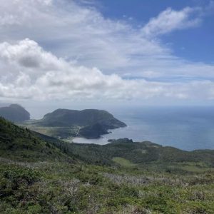
This hard trail is a 7km out and back with 610 meters of elevation gain. The trail starts in the cooper mine parking lot and ascends a flight of stairs. There are two lookouts along the way. The trail is very steep in sections with ropes to help you climb up.
The view at the top of Cape Blow Me Down is the tallest vantage point in the area and gives the best views of the entire bay of islands. Beyond the Cape is one of the entrances to the Blow Me Down Mountains multi-day backcountry hike.
The trailhead is here. Check out more details on this hike here.
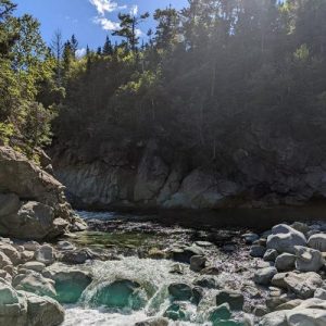
Copper Mine Falls Trail
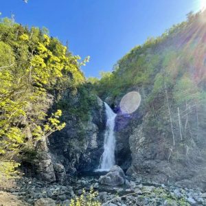
Amble through an easy, scenic 0.5-km trail to a beautiful waterfall at the end of the trail. The trailhead is here.
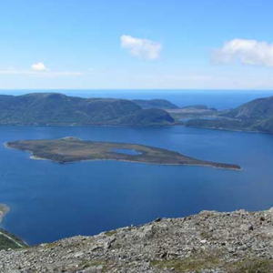
Hummock Trail
This moderate trail is a 7km out and back with 200 meters of elevation gain. The first 1.5km of the trail is on a well-worn atv trail before splitting off to the right to follow IATNL blazes. It will take you along a boggy trail to a small lookout offering unique views of the Bay of Islands and the Blow me Downs. Beyond this lookout is another of the entrances to the Blow Me Down Mountains multi-day backcountry hike.
The trailhead is here. More info can be found here.
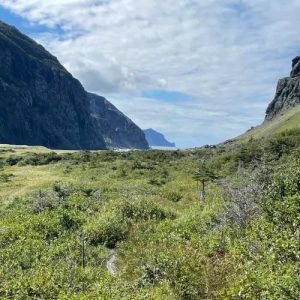
Blow Me Down Brook Trail / Blow Me Down hiking Trail / Blomidon Nature Trail
This easy 2km out-and-back trail with 50 meters of elevation gain. Another Trail with a confusing amount of names.This trail takes you along the foot of the Blow Me Down Mountains to the blow me down swimming hole in the brook. There is an intersection by the stairs that descend to the brook, where another alternate entrance to the Blow Me Down Mountains multi-day backcountry hike starts. Beyond this intersection, the trail quality drops right off.
The trailhead is here. More info can be found here.
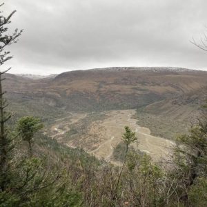
Blow Me Down Mountains Route
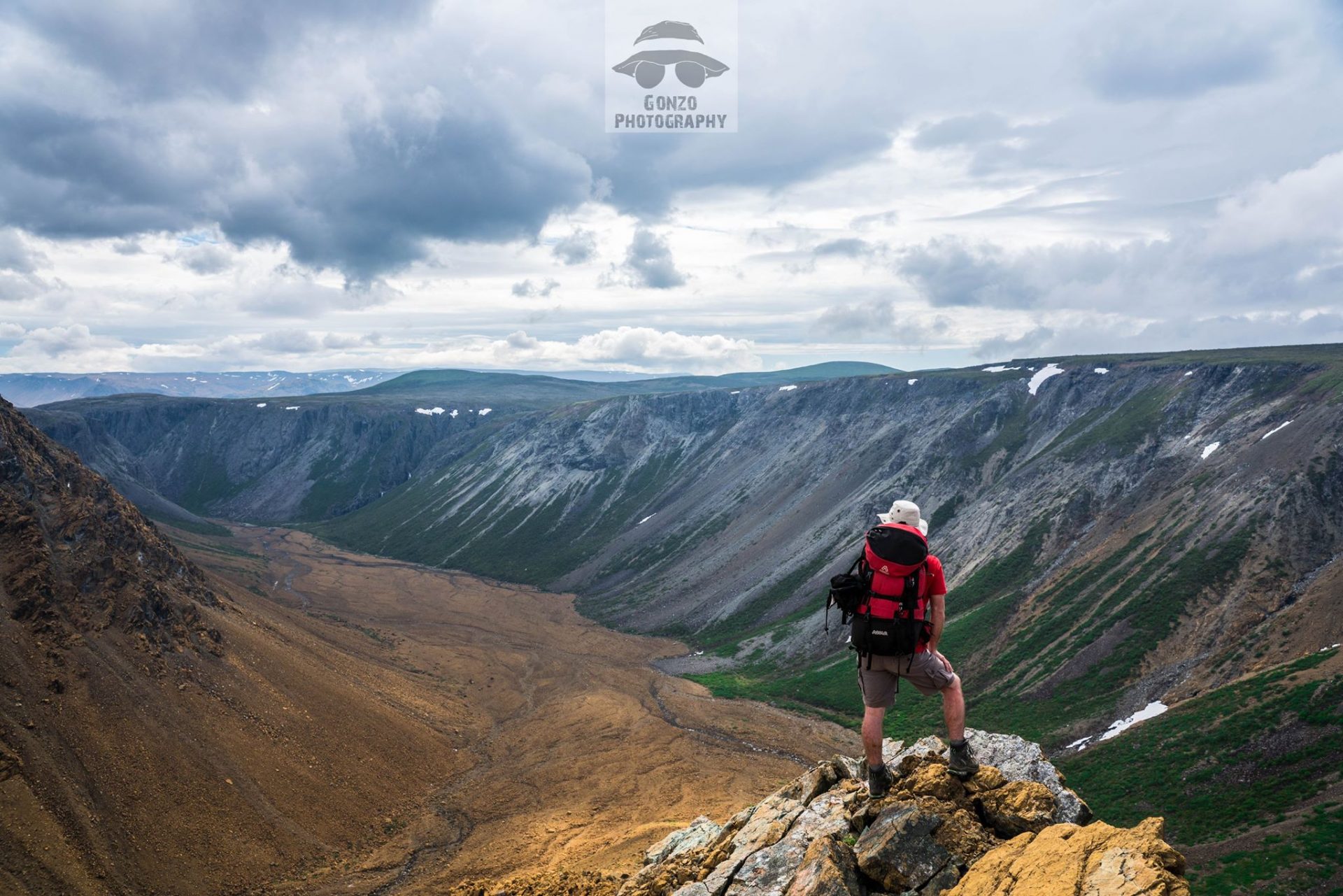
This very difficult hike varies in length depending on your route but is around 38km. It is a through hike so you will have to have a vehicle parked in the back of the Serpentine woods road. This hike has three different entrances from the Cape, the Hummock, and the Blow Me Down brook trails.
Hiking past The Cape, to Blow Me Down Brook Gorge, to Simms Gultch and Serpentine Valley this route has views that rival anything in Gros Morne. More information on this hike can be found on the International Appalachian Trail NL website.
Things to Keep in mind
This area’s hikes are known low levels of maintenance and rugged trail surfaces. It’s for this reason that hiking poles are recommended on all of these trails. A waterproof shoe is recommended for every month besides August as there are plenty of boggy sections in this region.
It goes without saying that a place named Blow Me Down is somewhere you can expect a lot of wind. Bringing a windbreaker no matter what time of year isn’t a bad idea. If you’re looking for a quick packing list check out this blog post on what to pack for a day hike in the back country.
There Are animals in this area as many of these trails don’t see much traffic for most of the year. While it is unlikely to come across a black bear they do live in the Blow Me Down mountains. If you’re going to run into anything it’ll probably be a moose. Check out this blog post on bear safety in NL for more info.
If you’re an avid hiker on the lookout for new trails check out The Hikes of Western Newfoundland. This book is a must have for any hiker in Newfoundland. It is the most complete guide out there of all the hikes on this half of the island.
What Else There is To Do Down the Bay
If you’ve got time to spare when you’re done with your day hike you can check out a few of these local businesses for a bite to eat or something else to do!
For zodiac, kayak, and hiking tours check out Everoutdoors in Humber Arm South.
For dory and fishing tours of the area Check out Island Getaways in York Harbor.
If you’re hungry checkout Myrtles On The Bay or Captain Cooks Galley in Lark Harbour. Big Tom’s Snack Shack is in York Harbour. The Salt Box is in Benoit’s Cove.
For Souveniers there’s The Roost At York Harbour.
If you’re looking for a place to stay check out the Blow me Down provincial park camping ground or the Captain Cook’s B&B.